Map integration in BT747
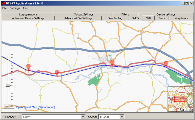
 OSM map in BT747
In the current implementation, tracks can be shown on the map. These tracks are created when using the 'Convert to' 'table in GUI' functionality.
The map data itself can be cached on disk after setting the cache directory in the file menu. In that case, the visited places are also visible offline.
The waypoints have two data sources:
- Waypoints identified in the log
- Waypoints identified by the 'Files to tag'
Waypoints can be moved on the map. Click and drag to do so. A right click on a waypoint will show some information regarding it.
Zooming can be done with the mousewheel
This fucntionality opens up possibilities for extended integrated filetagging in BT747 and offline mapviewing.
- Anmelden um Kommentare zu schreiben