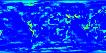
Differences between 'coarse' height correction and 'fine' height correction.

This images is a color rendering indicating differences between height corrections using a bilinear interpollation on a 10°x10° grid of the world and the more precise values using a 1°x1° grid.
Each pixel in this image is a degree and the lower left is -180, -90 (-180°W, -90°E). It would be nice to overlay this on an actual map.