User/External Tool Output
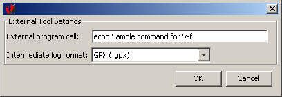
 User/External tool popup.
After clicking 'User', you can call upon an external tool do do specific operations with the position data.
To tag using 'exiftool', you could set the file format to 'GPX' and enter the following for the external tool call:
/directorytoexiftool/exiftool -geotag %f /directoryofmypictures/
For the GPS log ormat, Exiftool supports GPX, NMEA RMC/GGA/GLL and KML (as well as a few other formats not supported by BT747), therefore GPX is a good choice.
For the images, Exiftool support a lot of formats, including raw formats like .NEF.
- Printer-friendly version
- Login to post comments